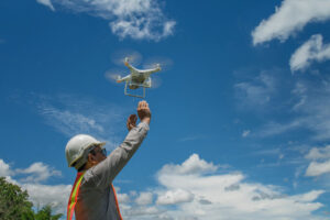
Drone photography/videography is playing a major role in the land surveying industry. Drones have the ability to capture images and video content from an aerial viewpoint, which can be a big help for land surveyors. Land surveying requires detail and exact measurement due to legal issues and other important factors that play into the industry.
There is a problem that we’re having today with drone photography because many people have the ability to use drones freely for their own benefits or hobbies. As a land surveyor, it’s extremely important to note that you need to be licensed as a land surveyor and a legal drone operator to capture images or videos for your job.
Why is There a Fine Line with Drones and the Law?
Drone use can be enjoyable, but for freelance photographers, you can be walking a fine line. If you are capturing aerial images with a drone for your business, those images and video can be used for the wrong thing. When it comes to land surveying, you’re capturing and collecting so much data that could be private to the world, so that is where the legal matters come into play. As someone who is not licensed, you could be facing legal issues by collecting that sensitive data. You always have to make sure you’re licensed if you’re a land surveyor.
The Benefits of Drone Use in Land Surveying
- Reduce Surveying Costs
- Decrease Field Time
- Increase Data Accuracy
- Create Access to Inaccessible Areas
The precise measurements in land surveying are very important. It provides the ability for land management and development. As a land surveyor, drone photography has made the career and work much easier, which can be of great help to everyone who is a land surveyor.
If you’re in need of land surveying, don’t hesitate to contact Scholle’s Land Surveying at 812-663-6526 today or visit us online for more information!


Leave a Reply